Beyond The Pavement: 360° Views of AZ from Squaw Peak

Looking for an amazing view? Look no further than Squaw Peak.
For RV Travelers Who Explore by Jeep or OHV:
Sitting along the mountain range on the south side of Verde Valley just above Camp Verde, Arizona is Squaw Peak. This peak was selected as a location for a plethora of telecommunications antennas due to its elevation and line of sight to other peaks used for similar purposes. Not only do you get an incredible view, but your phone signal will be insanely strong.
The views are commanding with a full 360-degree view of Arizona including Prescott, Prescott Valley and down the I-17 corridor towards Phoenix, picturesque mountains around Sedona as well as the snow-covered tops of the San Francisco Mountains near Flagstaff. So, whether you’re looking to get out and explore for fun or just want an incredible view, Squaw Peak is the place for you!
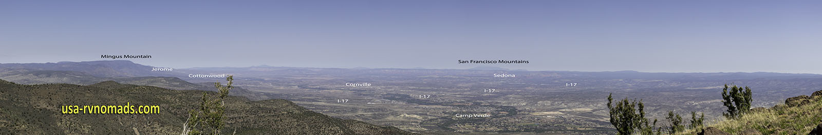
The view of Verde Valley and key points.
How to Find Squaw Peak
As you start near I-17 you will be traveling on the Great Western Trail for the first five miles of the road. It starts off as a maintained gravel road, passes by the fringes of Flower Pot and easterly towards the peak. Along the way the road intersects with other trails and roads. Eventually you reach a cattle guard that is the demarcation that you are entering the last stretch to get to the peak. The road isn’t maintained regularly beyond this point, but is sufficient for service vehicles to reach the top where the antenna farm is located. The peak elevation is 6526 feet.
If you’re looking for a great resource to help you find this and other 4×4 trails in Arizona, you’ll find this spiral-bound Guide to Arizona Backroads & 4-Wheel-Drive Trails 3rd Edition very useful. (This is an affiliate link, as well as a resource we relied on to find new trails to explore.)
Moderate Trail – Great for Jeeps NOT RVs!
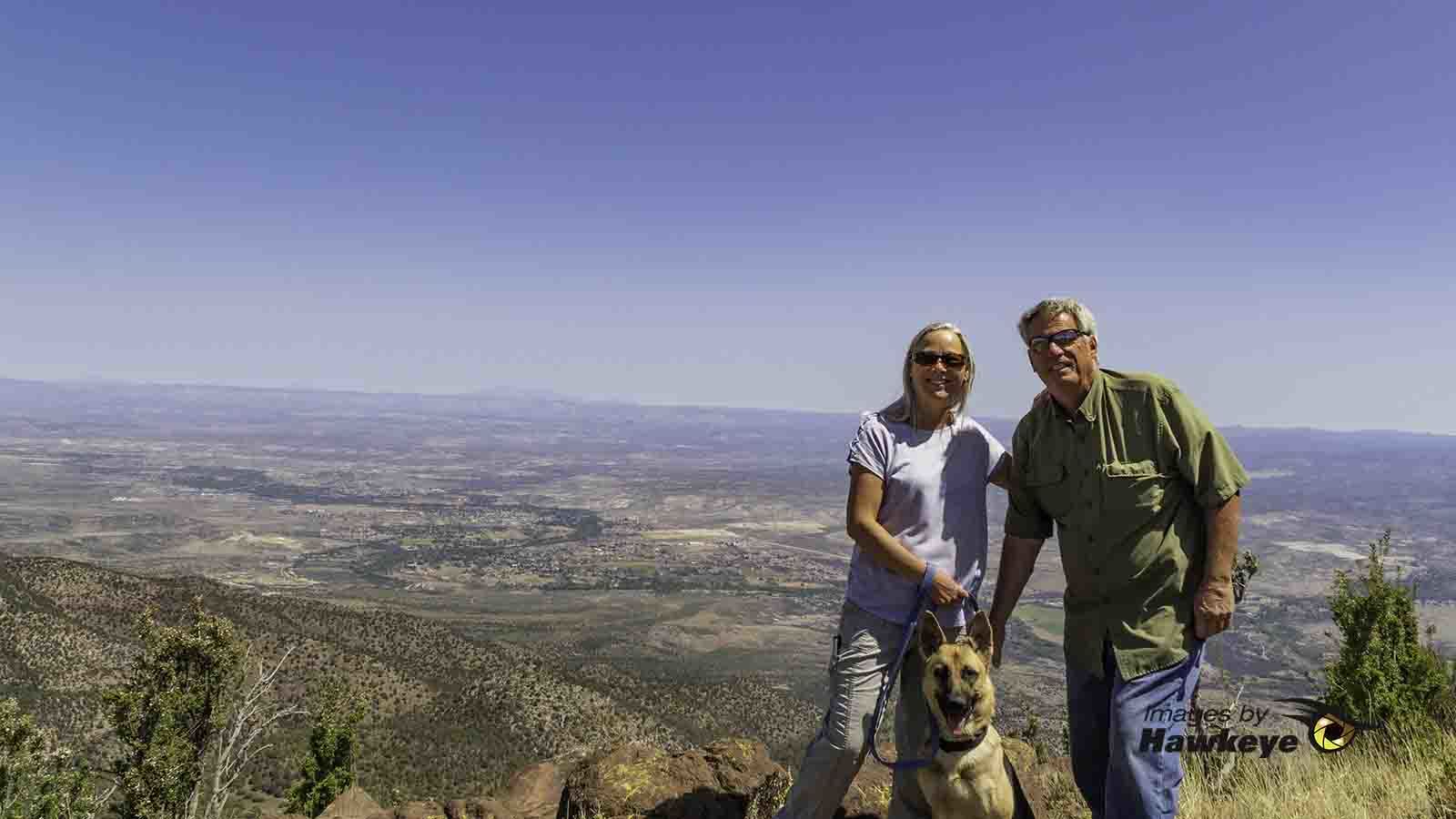
We pose with the Verde Valley, Camp Verde and the San Francisco Mountains as a backdrop.
It is approximately 20 miles from I-17 to the peak. The trail is rated as moderate, I rate it at the lower end of moderate. Some stretches are shelf road. Some mildly steep grades with rocks and gravel. I would avoid taking this road if rainy or snowy. The surface can get slick as there are places that are steep and dangerous when muddy.
Great RV Parks and Campgrounds in the Area
Our base camp for this area is at the Thousand Trails Verde Valley Resort. You’ll find several other great RV parks and campgrounds in the area. Staying in Cottonwood or Camp Verde makes it convenient to explore and visit the area attractions, cities, towns and historical sites. Oh, and do some great off-roading too!

Disclaimer: The links in this post are affiliate links, which means we get a small commission if you purchase through one of our links. It costs you nothing extra to do so and we greatly appreciate it!
We are a participant in the Amazon Services LLC Associates Program, an affiliate advertising program designed to provide a means for us to earn fees by linking to Amazon.com and affiliated sites.